Explore the entire state of FL
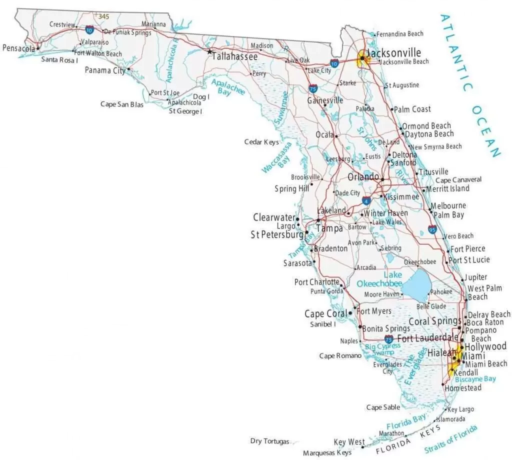
Check out the map below of all the cities in the state of Florida. Check out the all the coastal cities and towns in Florida both on the Atlantic coast and Gulf Coast.

A detailed representation of urban areas within the state of Florida. This visual guide showcases the various cities located throughout Florida, highlighting their geographical distribution and proximity to one another. It serves as an essential tool for understanding the state’s urban landscape, providing insights into the locations of major metropolitan areas, smaller towns, and significant landmarks.
The map not only illustrates the cities but also offers context regarding transportation routes, natural features, and regional boundaries. Such a comprehensive overview is invaluable for residents, tourists, and businesses alike, facilitating navigation and enhancing awareness of Florida’s diverse urban environments.
This detailed map highlights the various regions, including the bustling urban centers, serene coastal areas, and expansive natural parks that define the state’s unique character. The map serves as an essential tool for both residents and visitors, providing insights into the state’s infrastructure, major highways, and key landmarks.
In addition to the geographical features, the map also emphasizes Florida’s rich cultural and historical sites, allowing users to explore the heritage and attractions that contribute to the state’s vibrant identity. From the iconic theme parks in Orlando to the historic districts in St. Augustine, the map captures the essence of what makes Florida a popular destination for tourists and a beloved home for its residents. The inclusion of detailed topographical elements further enhances the understanding of the state’s natural beauty.